


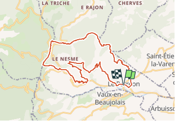

8.1 km | 11.9 km-effort


User


FREE GPS app for hiking
 SityTrail
IGN / Geographical institutes
SityTrail World
The world is yours!
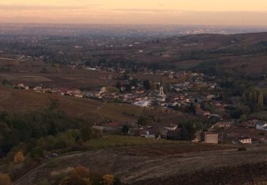
Trail On foot of 19.9 km to be discovered at Auvergne-Rhône-Alpes, Rhône, Le Perréon. This trail is proposed by JacouBrijou.
Belle randonnée dans le vignes et les crêtes au dessus du village du Pérréon

Walking
Walking

On foot

On foot

Horseback riding
Walking
Walking
Walking

Mountain bike
Belle randonnée !